HONDEX
HONDEX 8.4-inch Plotter Digital Fishfinder 8.4-inch HE-8SⅡ with Built-in Antenna TD28 HONDEX 45648
Product Number: 45648Couldn't load pickup availability
Product details
HONDEX by HONDA ELECTRONICS
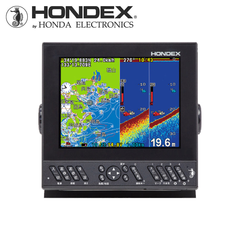
8.4-inch Plotter Digital Fish Finder HE-8SⅡ
No.45648 Built-in GPS (TD28)
●Output 600W Frequency 50/200kHz
●Dimensions/Weight: W248×D97×H216 mm / approx. 2kg
●Power supply voltage/power consumption/current: DC11~30V/approx. 12W/approx. 1A/12V
●Built-in detailed national map
●Equipped with Depth Mapping function
Easy navigation with intuitive operation!
With an easy-to-see and easy-to-use control panel and a clear, simple menu screen, even beginners can operate it easily without getting lost.
●Large Buttons
Large buttons reduce operational errors due to mis-pressing.
●Large Text Display
Large, easy-to-read Japanese text allows for smooth operation.
●Easy-to-Operate Button Layout
The areas for fish finder operation buttons and plotter operation buttons are clearly defined, enabling stress-free operation.
Equipped with Depth Mapping® function!

This function uses depth information from the fish finder and GPS position information to draw seabed topography on the map displayed on the screen. When seabed undulations not shown on standard maps are depicted, prime fishing spots become clearer *. It displays the seabed topography in different colors based on the acquired depth data.
[NEW] For shipments starting April 1, 2025, the operating depth for the Depth Mapping® function has increased from a maximum of 150m to a maximum of 300m.
*The Depth Mapping® function infers and displays seabed topography based on depth measurements taken while navigating. Actual topography may differ.
■ Approximately 50 hours of data can be stored internally (※1)
(※1): When recording distance interval is approx. 5m and boat speed is approx. 5kn. Recording time may vary depending on settings, boat speed, and other conditions. The shortest recording time is approx. 18 hours.
■ 30 blocks of data (approx. 50 hours each) can be stored in the map memory area of the main unit.
**Only one block can be displayed on the plotter screen at a time.
[Depth Mapping® PV]
Built-in GPS Antenna
The HE-8SII has a built-in GPS antenna.
※When using the built-in antenna, reception may not be possible depending on the installation location/method (when an external antenna is used, the external antenna takes precedence).
Bright, wide-angle bonded LCD screen!
The display boasts a very high resolution of 640x480 dots, allowing for clear visibility of subtle reactions and text.
Furthermore, the adoption of a high-brightness LCD (1000 candela) ensures excellent visibility even in bright conditions such as direct sunlight.
Additionally, the bonded LCD improves screen visibility and prevents condensation.
Displays rich information at high speed! Equipped with easy-to-view detailed national map as standard.
Equipped with a high-performance CPU, the map drawing speed is top-class in the industry! It smoothly displays coastlines even while traveling at high speeds.
Place names are clearly displayed in large, easy-to-read Japanese text.
HONDEX Di Series: The Ultimate in Fish Finder Performance!
The HONDEX Di-Digital Series introduces new technology that directly converts weak received signals into digital.
Optimal filtering according to the situation is possible, displaying the optimal image according to water depth.
The latest digital technology has achieved high-quality image representation with less noise.
-Exactly what you wanted! Diverse features unique to digital-
Fish Size Display
The digital series adds size display to the popular fish character function.
It can be judged by sizes 1 to 99, and a one-touch function for "display/hide" and a two-screen display with the normal screen are adopted to instantly confirm reactions in actual images.
*This function can be used within a 100m range.
*The numerical values for size display may vary due to various factors. Please consider them as reference values only.
Fish Depth Display
Height from the seabed and depth from the sea surface (unit: m) have been added to the fish character display.
*This function can be used within a 100m range.
*The numerical values for depth display may vary due to various factors. Please consider them as reference values only.
Dual-Screen Display on the Same Frequency
You can split the fishfinder image of the same frequency into two screens and adjust the sensitivity of each.
By comparing the two screens, you can set the optimal sensitivity.
Full-Screen Sensitivity Adjustment
With previous fish finders, changing the sensitivity would take effect from that point on. However, digital fish finders now allow you to change the sensitivity on the screen (past records).
With this feature, you can adjust the sensitivity while viewing the entire screen (past records), allowing even beginners to manually set up clear images.
Can connect to Heading Sensor HD03!
The Heading Sensor HD03 can be connected! You can ascertain the bow direction even when stopped, which is perfect for drift fishing!

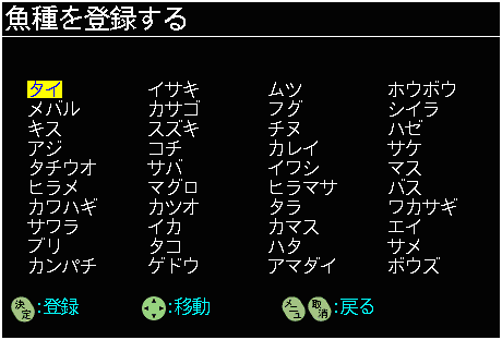
[NEW] Register and search fish names!

The "Fish Data Function", which allows you to register fish names (species) when registering points, is scheduled to be installed in shipments starting April 1, 2025. It is also possible to search for registered fish data.
Main Specifications
| Display Unit | Type | 8.4 inch LCD |
| Display Screen | Horizontal | |
| Display Dot Count | 640×480 | |
| Power Voltage | DC11~30V | |
| Power Consumption/Current | Approx. 12W Approx. 1A/12V | |
| Dimensions (mm) | W248×D97×H216 | |
| Weight | Approx. 2kg | |
| Fish Finder | Frequency | 50/200kHz |
| Output | 600W | |
| Display Range *1 | Max: 0~1000m | |
| Min: 0~5m | ||
| Background Color | 4 colors | |
| Color Scheme | 5 types | |
| Auto Function | Within menu | |
| Depth Alarm | ON/OFF | |
| Magnification | OFF/Auto/Manual/Bottom Lock | |
| Magnification Ratio | 2x/4x/8x | |
| Plotter | Scale Size | 0.005~200NM(km) |
| Plot Interval (Time) | 1, 5, 10, 20, 30 seconds 1, 2, 5, 10, 20 minutes |
|
| Memory Points |
Tracks: 32,000 points Marks: 24,000 points |
|
| Track Display Color | 7 colors | |
| Drawing Function | ○ | |
| Map Fill/Rotation | ○ | |
| Map Data | Detailed national map | |
| Tide Graph | ○ | |
| NMEA Output | ○ | |
| Antenna *2 | GPS built-in |
*1 The display range does not indicate the depth measurement capability.
*2 Since the antenna is built-in, reception may not be possible depending on the mounting location.
Compatible Options (Sold Separately)
|
Water Temperature Sensor |
Thru-hull type | TC02CS(15m)+TCK01 |
| Transom type | TC01C(6m), TC01G(3m), TC02ES(15m)+TCT01, TC03-05(5m), TC03-10(10m) |
|
| Multipurpose Pipe + Transducer Mounting Bracket | BP05+SK05, BP10+SK05 | |
| External GPS Antenna | GP-16H(L) (10m) | |
| Heading Sensor Built-in GPS Antenna |
GP-16HD (10m) | |
| Heading Sensor | HD03 (10m) | |
| In-dash Mounting Bracket | 〇 | |